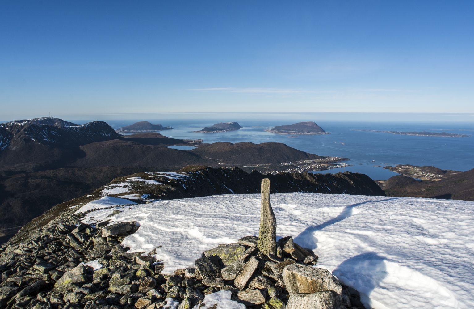
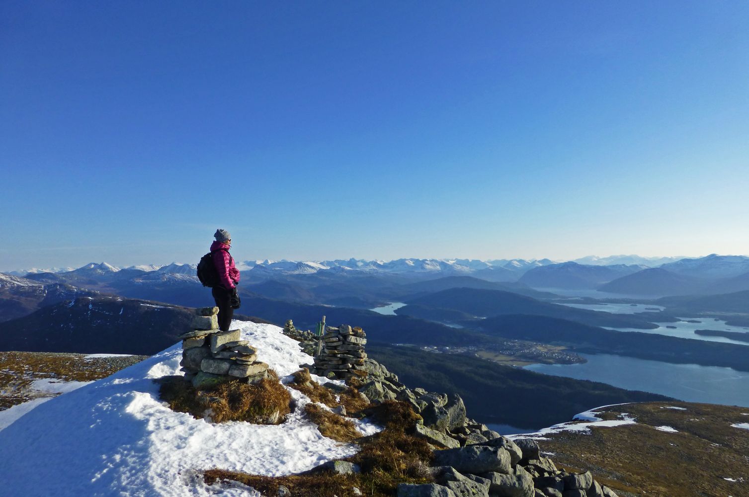
Urfjellet (838 m a.s.l.) is the sixth highest mountain in Haram municipality and the southernmost peak of the massif east of Brattvåg. From here, you will get a magnificent view in all directions. You will see the ocean and the Nordøyane islands in the north, the magnificent Sunnmørsalpane in the southeast and have a great view of Grytafjorden, Ellingsøya, Ålesund and the islands in Giske municipality in the west.
Route description
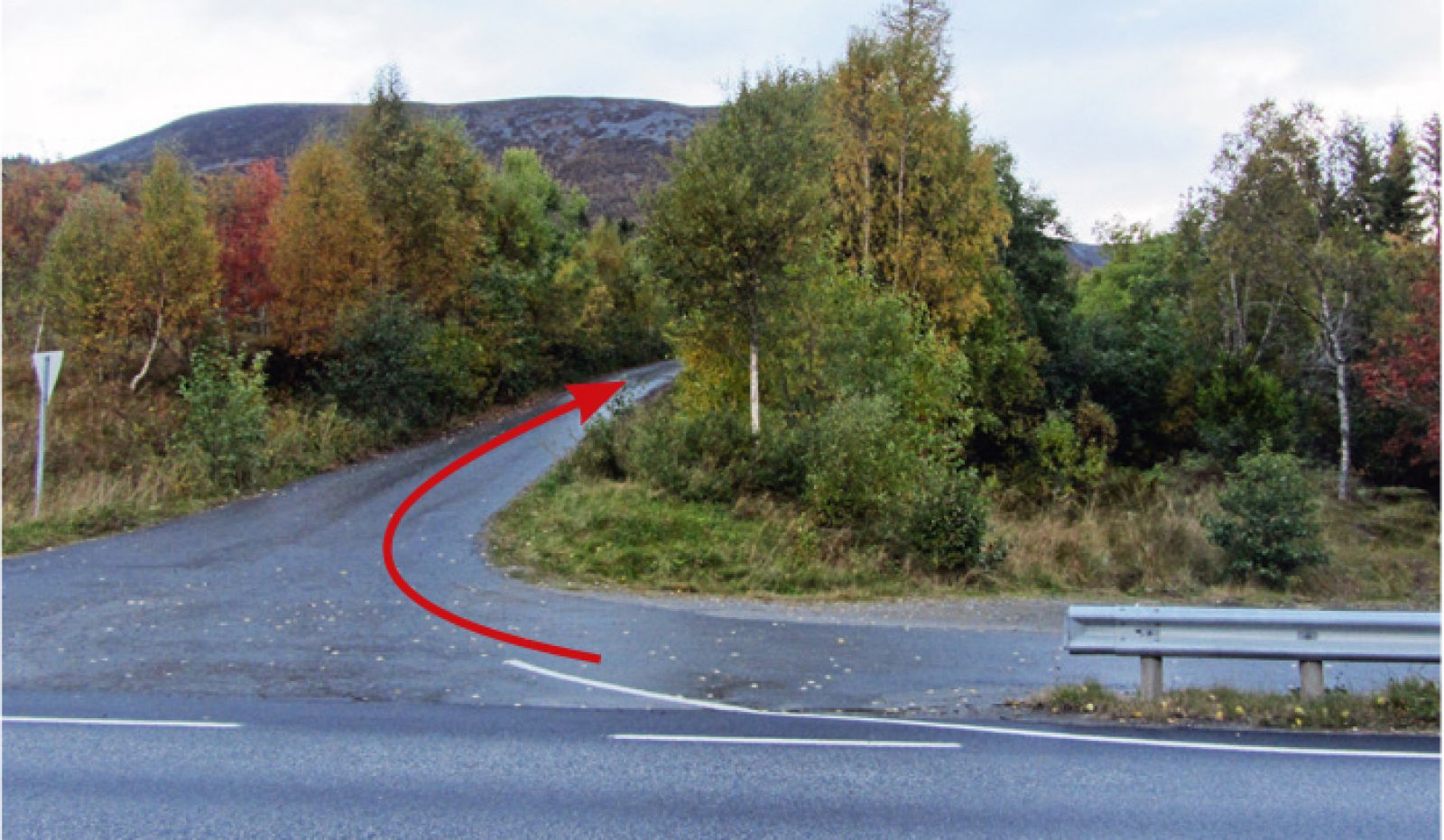
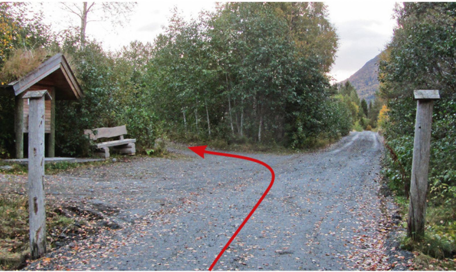
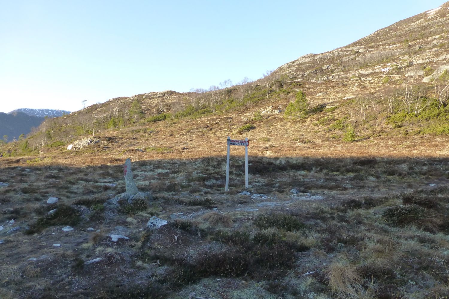
Go north from the car park following the road that runs parallel to the river (it will be on your right-hand side, if you came by car facing Slyngstad). After about 400 metres, just as you pass a cattle grid, you will come across a board with the information about fishing licences. Take the turn to the left at the sign to Remmefjellet and Urfjellet. You will soon see a couple of cabins where you need to turn left onto a path leading through the dense spruce forest. The path is normally a bit wet. Once you come out of the forest, you will see an old church road between Slyngstad and Remme. Take the right turn onto the nice and dry forest road as it gradually ascends towards Mount Remmefjellet. Follow the road as it runs over gentle terrain of Remmefjellet for quite a while until you come to the sign pointing to Mount Urfjellet where you need to turn right. The path here is well-trodden and marked all the way up to the cairn at the top. The section of the path that climbs steeply up towards Remmeheia can be a bit wet. Once you reach the height at which you can see Brattvåg and the Nordøyane islands, the path will get drier and the ascent will ease. Walk through the nice flat section on Remmeheia up to a new ascent which goes through patches of scree and some vegetation. You will come across another small flat area before the final climbing to the top begins. The way up follows the southeast hillside. The top plateau consists of scree, and you will see several cairns along the ridge.You can combine this trail with a number of other routes. If you walk further past the cairns and along the ridge at the top, you will come to the Bergetindane peaks. This is a narrow passage of steep hillsides going straight down. To continue further, you have to be an experienced climber and have no fear of height. There are difficult sections that involve quite hard climbing. It is not recommended to go there when it is wet or slippery. You can continue further to the mountains Storfjellet, Keipen and Hellandshornet towards the northeast. These are beautiful mountain peaks of the same massif with approximately the same height. There is no clear or waymarked path here, but the surface is solid, dry and nice to walk on.
Cairn at the top
Access and parking
Turn off E39 onto County Road 661 (Fv661) towards Brattvåg and Vatne. Drive along Fv661 past Lake Engsetdalsvatnet and cross the border of Haram municipality. At the junction in Eidet, take the turn to the left onto County Road 659 (Fv659) towards Brattvåg. After about 3.5 km you will come to a bridge over a river. There are parking spaces here on both sides of the main road.
If you are coming from Ålesund, you can drive along National Road 658 (Rv658) via the undersea tunnel and then across the island of Ellingsøya following National Road 107 (Rv107) towards Stette in Skodje municipality. When you reach the junction with the sign pointing to Rv661 towards Brattvåg, turn off to the left. From the sign marking the municipal border of Haram, follow the same route as described above.

 Driving directions
 Route data