Tusshornet, route 59
Vanylven
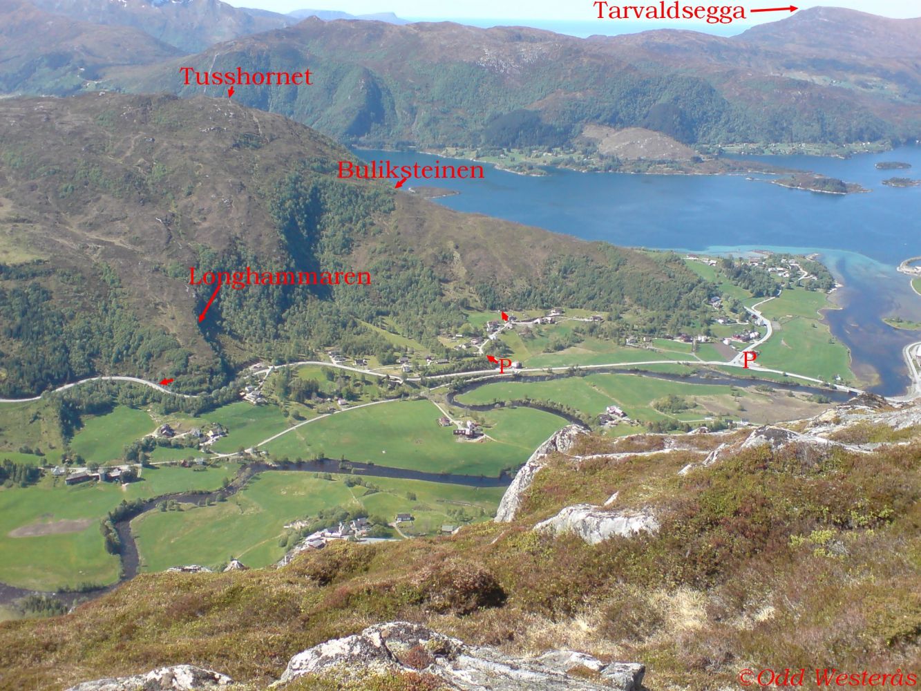
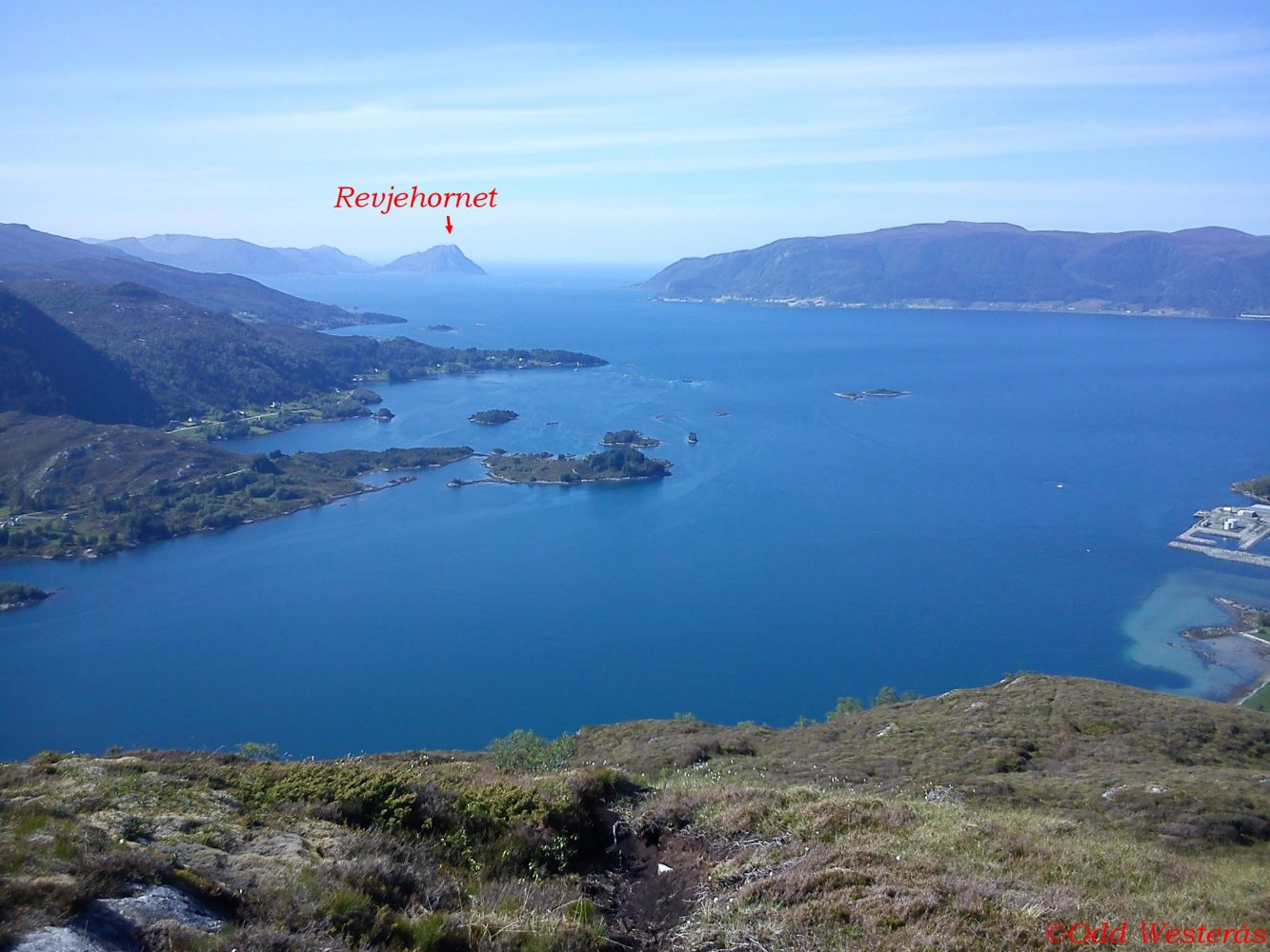
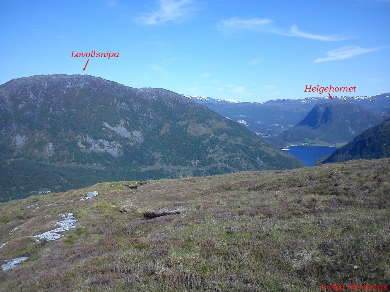
Tusshornet Hill is a fantastic viewing point. You can enjoy the view of the entire Vanylvsfjorden and watch the sunset over the sea outside of the Stad (Stadlandet) Peninsula. You will also get a view of Kjøde in the inner part of the fjord, the highest mountain in Selje, the Stadt Peninsula, Fiskå/Hovda and the valley in Åheim, and of course, the view of the picturesque village of Åheim itself.
This description is made for a loop trail, but you can also choose to follow the same route both up and down. There are two marked routes for a there-and-back trail. You can either walk up from Sjurledet, which is where the ascent starts when you are driving from Åheim to Nordfjord, or from Longhammaren Hill, which is just after the large right turn above the old Norwegian Public Roads Administration’s garage. There is a sign for Tusshornet there. There is also an unmarked route that starts at the old Thue school, runs towards the mountain ridge, and follows it up to the top. You will walk onto a marked path from Sjurledet on a hillside just below the Buliksteinen stone.
The following is a description of the trail up from Sjurledet and down the hillside of Longhammaren:
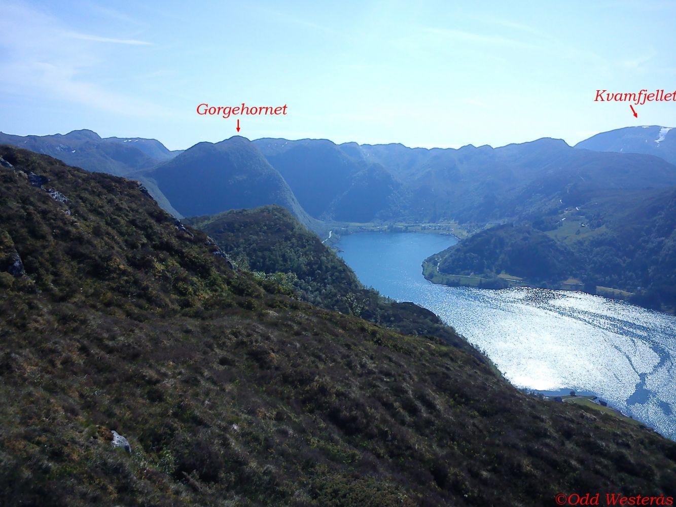
The trail starts from FV61 at the beginning of the ascent on the way from Åheim to Nordfjord. Follow the gravel road that runs up to the right (west). You will reach the highest point of this road after about 200 m. There is a sign pointing to Tusshornet there. Turn left and walk up the tractor road. You will see a gate at the end of the tractor road. Please close the gate behind you since there may be animals grazing in the area nearby. From that gate, the trail is marked until you come down to FV61 near Longhammaren. Walk into the forest just after the gate. You will come out of it after about 75 m. From there, you will walk through open terrain until you are almost down by Longhammaren. Follow the marked path up to the hilltop. About half way between the gate and the top, you will come across a large stone that has been named Buliksteinen. You are now high enough to get a view over the mouth of Vanylvsfjorden. This is a nice spot to take a break, rest on the stone and take in the view. After Buliksteinen, follow the good-quality marked path to the hilltop. About 100 m before the top, you will come across a path that runs down to Longhammaren. You will get to enjoy the spectacular view over Vanylvsfjorden once you reach the trail registration point set up by the Åheim Sport Association. We also recommend taking a 70 m long detour towards Nyken. Walk around the stone and keep slightly to the right where there is a fantastic viewing point over the inner part of the fjord with Skorge and Kjøde in your line of sight.
From Tusshornet, there is also a marked route south towards Nyken and further to Vaulsnipa and Kyrnosa. Another marked path runs from Kyrnosa to Gorgehornet and down to Skorge with the option of walking down Tusentrinnstrappa (Eng. The Stairs of a Thousand Steps).Follow the same path that brought you up for the first 100 m of your return trip. Then walk straight ahead towards a rocky outcrop with a stone on top. Keep to the right when you walk down here since the rocky surface can be slippery. There are several rocky outcrops on your way down which may be slippery when it is wet, so please do not approach the edges while you walk there. The path down is not as well marked as the one that goes up, but it is still easy to find the route. On your way back, you will enjoy a beautiful view of the village of Åheim with the fjord and the valleys further away. Walk through the gate down by the county road. Please remember to close it behind you. Follow FV61 to the left for about 700 m until you are back at the starting point.
From the junction in the centre of Åheim, drive over the bridge and continue south towards Måløy. Just after the beginning of the ascent over Maurstadeidet, you will see a road that goes up to the right. The distance to the starting point from the centre of the village is about 700 m.
There is room for a maximum of only two cars at the start of the trail which is just below the mailbox stand. Alternatively, you can park by the religious centre Misjonshuset and walk south along FV61 for 400 m until you reach the starting point of the trail. Both parking options are free of charge.
Distance
3,55 km both ways
Duration
1 t. 45 min.

| Surface type |
Distance |
| Asfalt |
0,81 |
| Sti |
2,4 |
Hiking map: På tur i Vanylven (Eng. Hiking in Vanylven) – can be purchased at local shops and petrol stations in Vanylven Municipality.
 Driving directions
 Route data
GeoJSON