Trollevasshornet
Vanylven
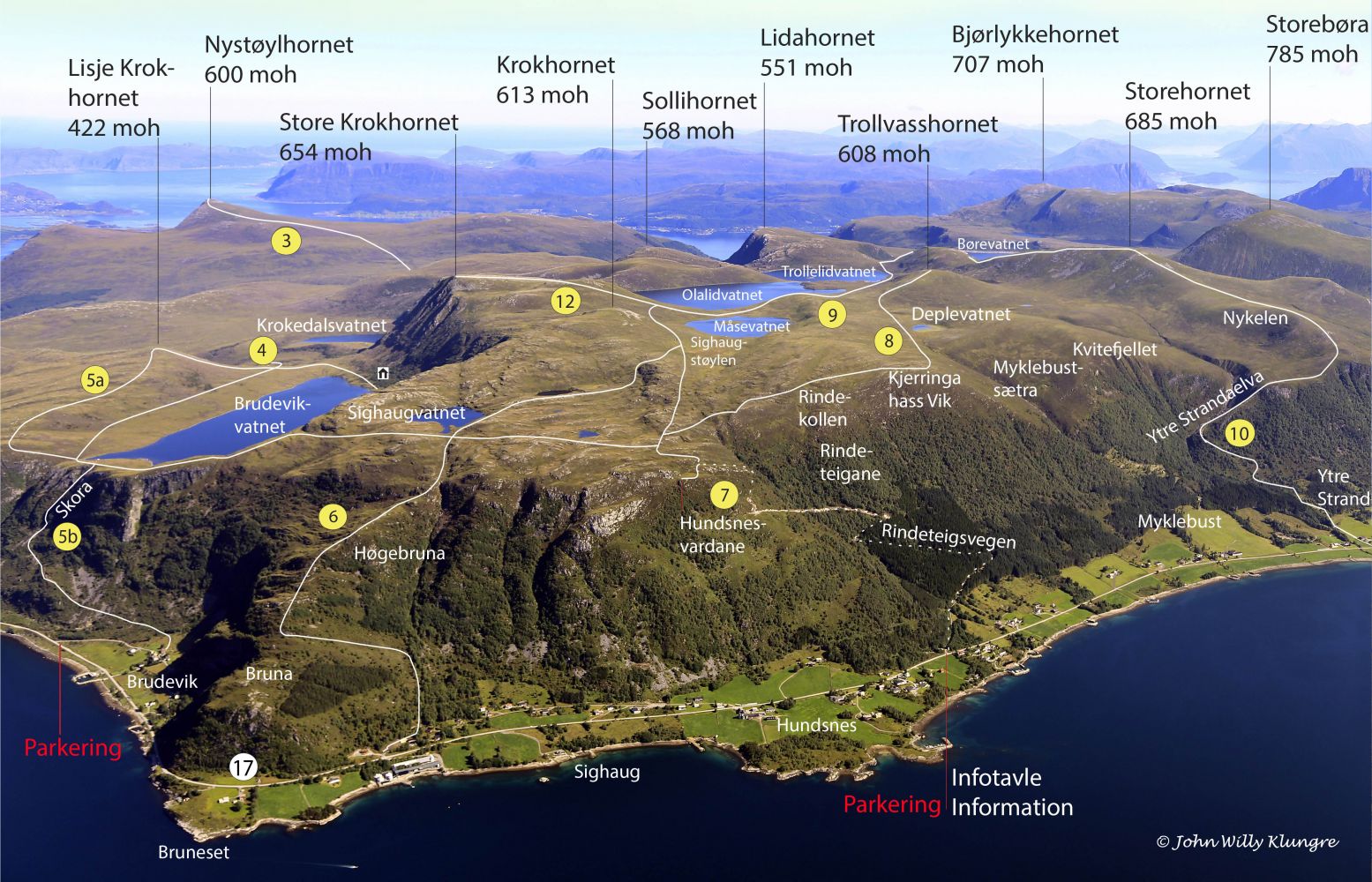
This is a relatively easy walk over gentle terrain once you have completed the uphill section along the gravel road leading to the mountain edge. It can either be a fitness trail or a relaxed walk over some marshy areas and mountain ridges to a peak that, despite its modest height, offers a nice view. This trail is marked as Route 8 on the hiking map of Vanylven.
Follow the road up from the car park at the timber stacking area. About halfway through the ascent, the road splits in two. Turn left. There are many picnic areas with tables along the way. Once you reach the end of the road, you will see a signposted and marked path. The path is mostly clear and easy to follow, and it involves less climbing than along the gravel road. The path mostly follows the mountain edge until it reaches the viewing point called Kjerringa Hass Vik. From there, it turns towards a gently sloping valley past Lake Deplevatnet. This lake is shallow and almost overgrown, which shows how marshes are formed. The path becomes less clearly defined as it runs along the lake. The ascent to the peak begins after the path has made a turn around the marshy area. It is usually windy at the top, even when the weather is quiet on the surrounding peaks that are higher.
The starting point of the trail is an area for stacking timber 6 km west of Fiskå. Here, there is plenty of parking space and a trail sign. There is also a board with a map, photos, and information about other trails in the area.

 Driving directions
 Route data