Norsk

Svartetua from Eidså (842.5 m a.s.l.), routes 18–19 – great view and mysterious cultural sights

Vanylven

The trail at a glance

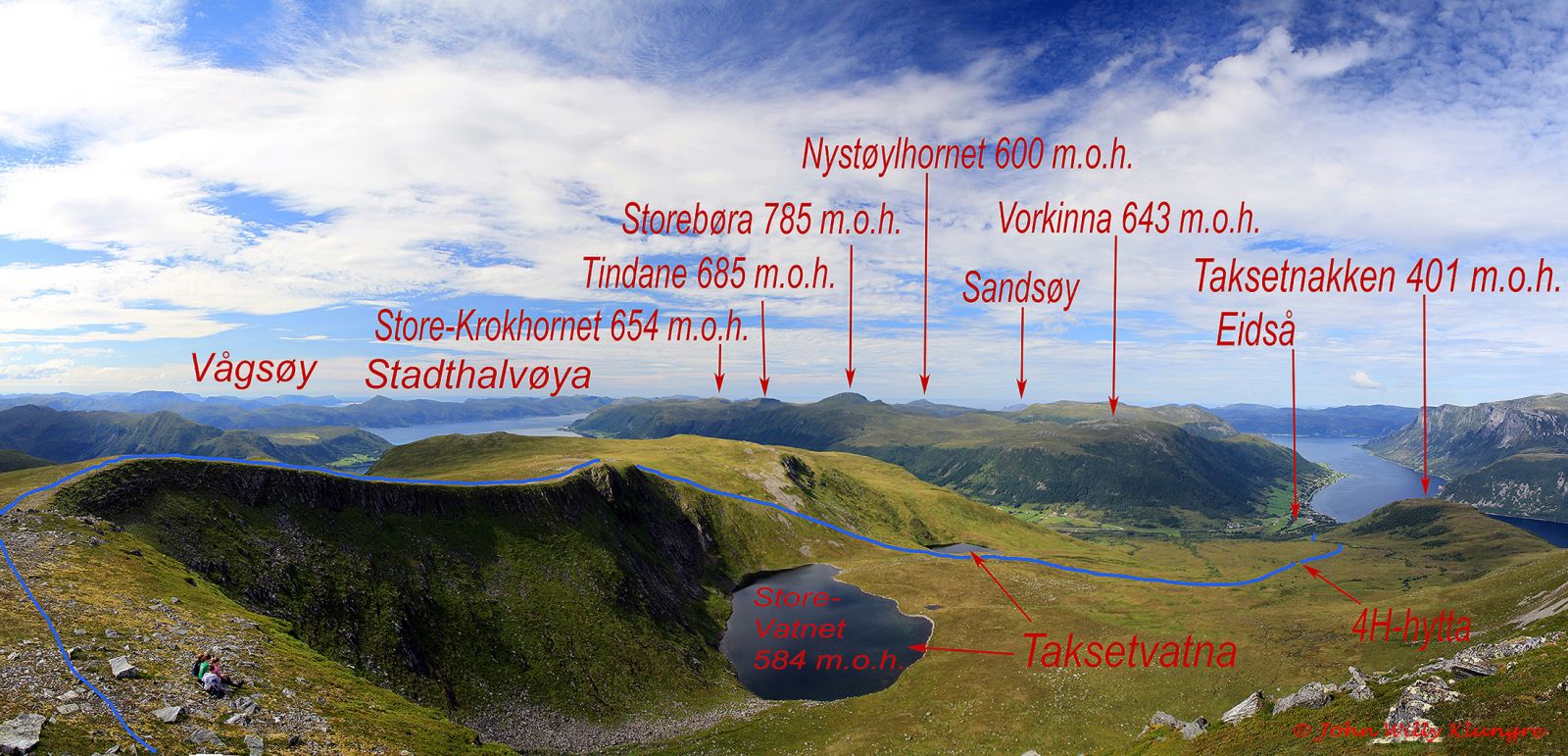
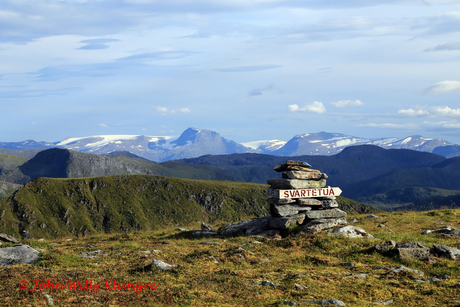
Svartetua is the highest point between the villages of Syvde, Eidså, and Fiskå that offers a beautiful view in all directions. The trail runs through fairly gentle terrain from Eidså to Svartetua via the cabin that was built by the 4H organisation. It starts along a cart track and later becomes a path. Up to the 4H cabin at 300 m a.s.l., you will walk through very easy and family-friendly terrain, and route finding will not be a problem. The trail gets slightly steeper and more difficult as you move forward, and the ascent to Storevass-skaret will be the hardest and steepest section. The top of Svartetua is considered to be the small crag that sticks out of the relatively flat plateau slightly west of the mountaintop itself. The path from the 4H cabin to the top of Svartetua is marked with blue sticks and blue paint in the terrain. Alternatively, you get to Svartetua by following the route “Right up Blåfelden” http://mrfylke.no/Morotur/Turer/Blaafelden-rett-opp-rute-54 In that case, you will come up to the highest section of the plateau. There, you will see the sign for both Svartetua and Blåfelden. Svartetua lies about 200 metres southwest of that sign.

Route description

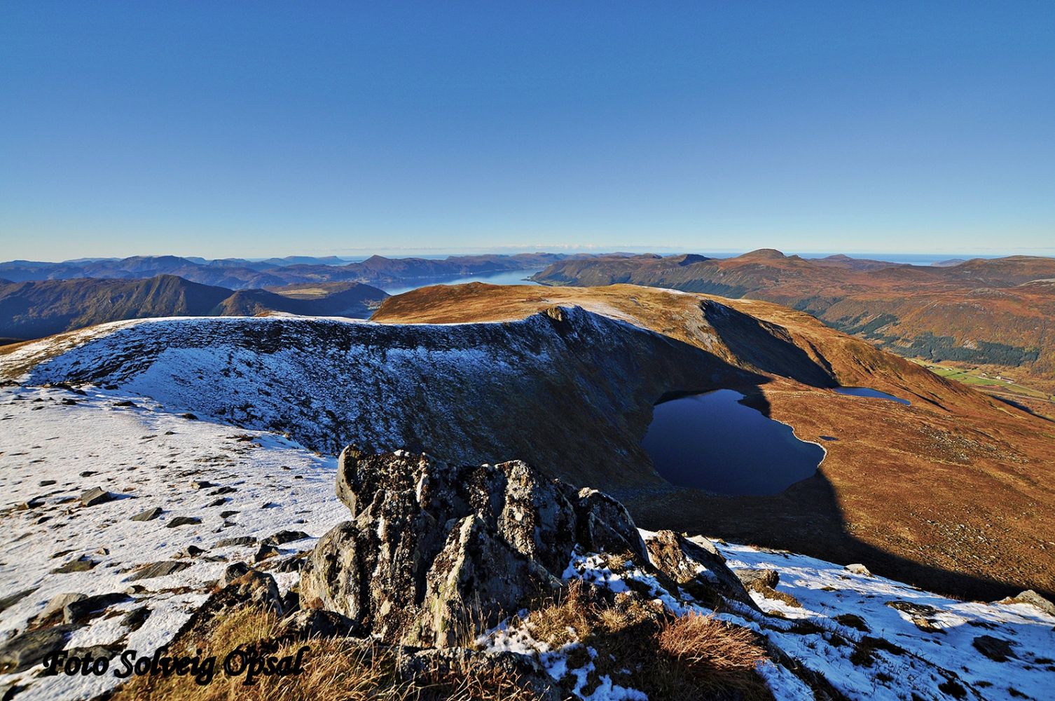
Begin by walking in the direction of Svartetua and the 4H cabin. A tractor road/prepared wide path will take you all the way up to the cabin. From there, the path is mostly good-quality and clear. You will soon reach the two Taksetvatna lakes. The path follows a moraine ridge between the lakes Lisjevatnet and Storevatnet. Each lake lies in a cirque that was formed by cirque glaciers. There are many cirques like these in Vanylven Municipality, and most of them are facing north or northwest. The cirque around Lake Storevatnet is one of the biggest and most spectacular of its kind in the entire municipality. The most challenging section of the trail is up the mountain gap Storevass-skaret. When you come up to the edge of the mountain plateau, you will walk on a solid and easy surface all the way to the top of Svartetua.

Access and parking

To find the beginning of the path, drive from Eidså and turn in the direction of Syvde at the junction of national roads 62 and 651. Turn right after 500 metres and follow the old national road. Drive for about 400 metres until you reach Mesta’s road station. Just before the road station, you will see a sharp turn to the right up a relatively steep hill and the first signs pointing to Taksetnakken. It is often difficult to park your car at the starting point of the trail, so you can park by the road station instead and walk the remaining 300 metres up to the start.
Hiking route
Red
Distance
5,00 km one way
Elevation
776 m
Duration
4 t. 30 min.
Highest Point
830 masl

Map route

Surface type Distance
Sti 6

Map

Hiking map: På tur i Vanylven (Eng. Hiking in Vanylven) – can be purchased at local shops and petrol stations in Vanylven Municipality.
Driving directions

API endpoints

Route data GeoJSON