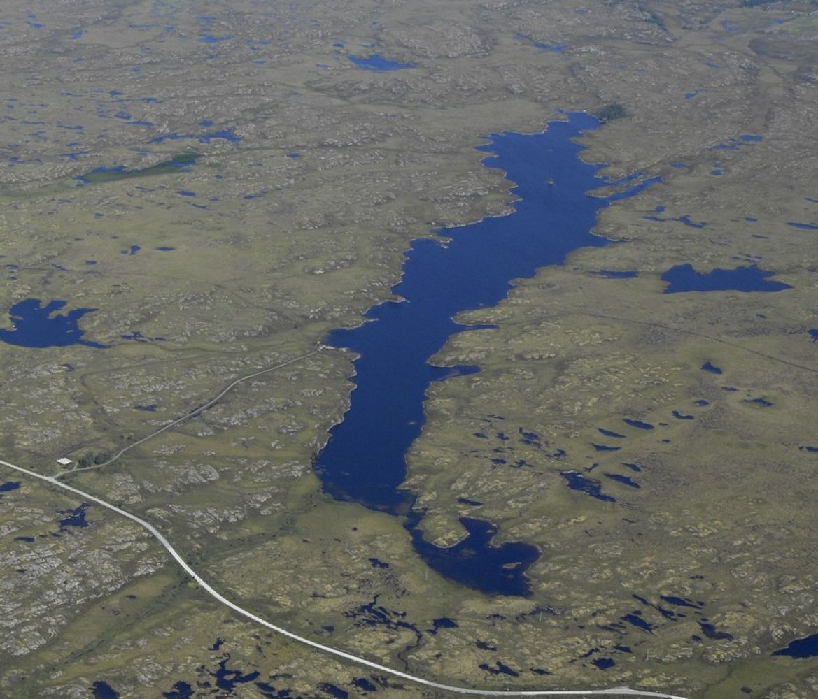
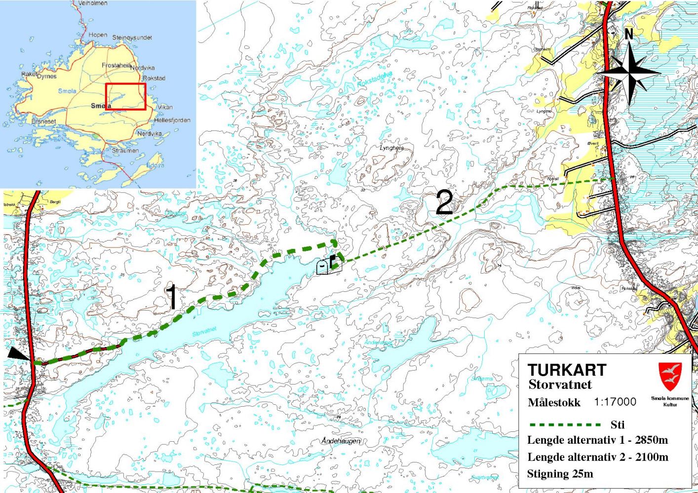
Lake Storvatnet is located in the Midt-Smøla nature reserve right in the middle of Smøla Island. It is considered to be a part of the marshy areas and moorland on Smøla Island that became protected areas in 2009. It takes about 30–40 minutes to reach the end of the lake. The trail is 2.85 km long, and the terrain is quite uneven and wet. Parts of the path lie all the way down by the water, and during periods of heavy raining it is possible to wade through the water in some places. Lake Storvatnet used to be the source of drinking water for large parts of Smøla. You will see an old pumping station at the start of the path. The path that leads up to the trail postbox is on your left-hand side. The trail is clearly seen the entire time. Many recreational fishermen go fishing in Lake Storvannet, and they walk along some parts of this path. Once you reach the cabin at the end of the lake, you will see the trail postbox attached to the cabin wall. Write your name in the trail journal.
Several paths lead up to this trail destination. The one we would like hikers to use starts from the radio tower, goes down to the lake and continues to the cabin at the end of the lake. But there are other paths as well. The trail from Rokstad leads up to the trail checkpoint on Tverrbakkhaugen. From there, you can continue walking up to Lake Storvatnet. If you keep on walking down from Lake Storvatnet to Rokstad, you will get a looped trail. The locals on Smøla Island like to walk in various directions all across the marshes. Their footprints form paths. More people should use these paths since it is beneficial for health to walk on marshes.
Coordinates of the end of Lake Storvatnet: 63.397942, 8.111262
The trail starts once you arrive at the island of Edøya/Smøla by express boat or by ferry. County Road 669 goes around the island.
From Edøya, drive for 8 km onto the island of Smøla until you reach a junction. Turn right at the junction and drive for 5.5 km to Nelvika. You will come to another junction with the road to Frostadheia on the left. After about 6 km you will reach the radio tower which is clearly visible. This is where the trail can start.
You will find the trail sign there. It is also possible to drive along the gravel road down to the lake, but you can just as easily park your car next to the sign. Walk down the gravel road until you reach the old pumping station down by the water. The path is to the left of the gravel site near the pump house. The terrain is quite uneven and wet. Parts of the path lie all the way down by the water, and during periods of heavy raining it is possible to wade through the water in some places.
Park your car near the radio tower or follow the gravel road down to the lake and park there.
Duration
1 t. 20 min.

Sesong
Spring, Summer, Autumn
Signage
Both signed and marked
| Surface type |
Distance |
| Sti |
5,7 |
Smøla is a great cycling destination. A cycling tour to Lake Storvatnet is a good idea whether you use any of the accommodation options on the island or get to Smøla by express boat/ferry. A bike rental service is available at Gurisentret which you will find on the quay on Edøya. Phone: 71542600. You can also rent bike trailers and child bike seats there.
The regular bus does not go there.
A small river runs at the end of Lake Storvatnet. We have built a small bridge over it, but it was torn off by high water and ice. This is why you might need to take a detour in order to cross the river. But it is manageable.
 Driving directions
 Route data
GeoJSON