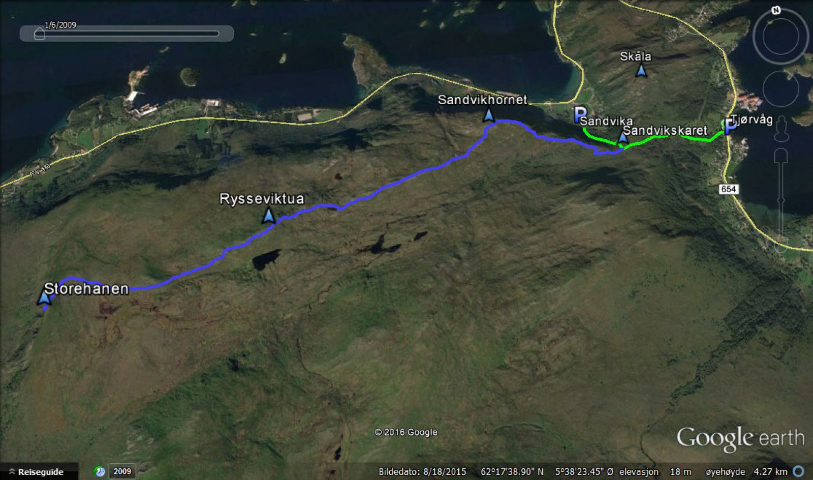
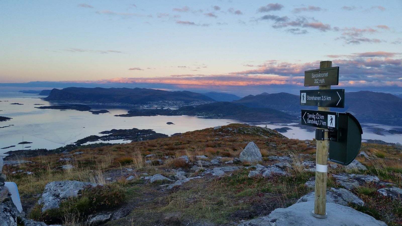
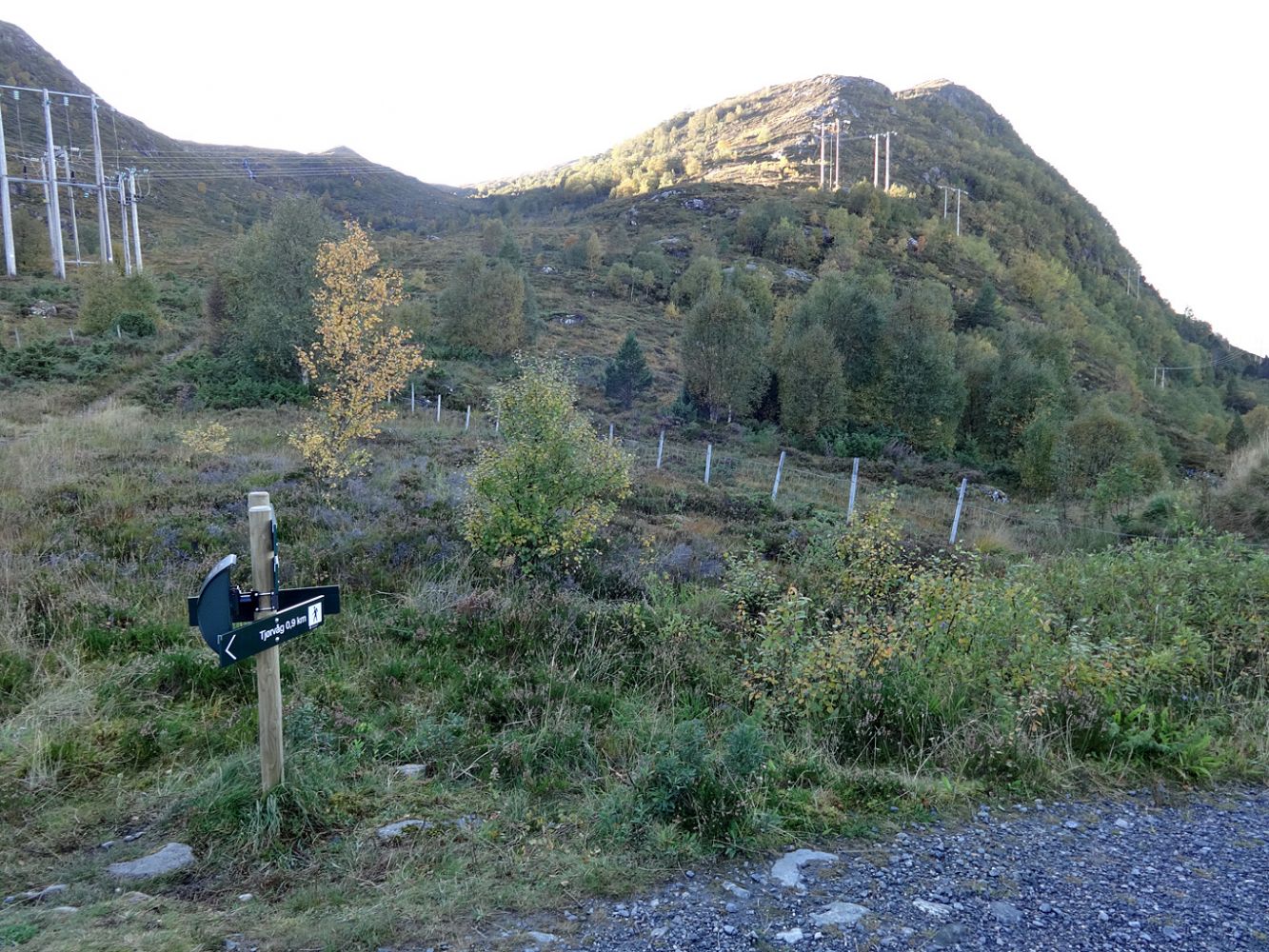
Sandvikhornet is a popular hiking destination that offers a scenic view of the islands in the north. The trail has a starting point in either Tjørvåg or Sandvik. The area further west towards Storehanen is also good for both hiking and skiing, so we definitely recommend exploring it. If you come from the east (Sandvikhornet), you can either go back the same way or walk over Selsteinen and return to the starting point in Tjørvåg via Slettheia and Øyrahornet (the route from Selsteinen to Øyrarhornet it is not marked, and there is a poorly defined path only in some places). The route from Øyrahornet down to Tjørvåg is marked (please see a separate trail description on morotur.no).
There are also several marked routes to Storehanen from the Moltudalen Valley, but they lead to a different destination to the one that the marked route from Sandvikhornet goes to. Explanation:
The route from Tjørvåg or Sandvika (via Sandvikhornet) takes you to a mountaintop that norgeskart.no calls Storehanen, 491 m a.s.l. The sign at the top (which will appear here in 2016) will read “Storehanen, høgste pkt. 491 moh.” (“Storehanen, the highest point 491 m a.s.l.”) On the side of Moltu, the mountaintop is said to have no name or is called Blåfjellet. The destination of the routes from the Moltudalen Valley is a point that is not marked on norgeskart.no, but has a sign that reads “Storehanen 471 moh.” (“Storehanen 471 m a.s.l.”) at the top. On the Norwegian economic map, this point is marked as Moltuhanen and has a height of 451.9 m a.s.l. It is not uncommon for two villages to have different names for the same mountain.
About halfway between Sandvikhornet and Storehanen, there is a cairn on a hill that does not have any name on the map. This cairn is a popular hiking destination for many people. According to the economic map, this hill is about 440 m a.s.l. On a historical map from 1866, it may look as if the hill is called Rysseviktuen, but this name may also refer to the 425-metre-high hill further east, which lies closest to Ryssevika. Another possible name for the 440-metre-high hill with a cairn on top is Kjempekollen.
This is a description of the routes to Sandvikhornet and Storehanen from Tjørvåg and Sandvika. As mentioned above, there are also several marked trails to Storehanen from the Moltudalen Valley.
From Tjørvåg: start walking from the convenience store in Tjørvåg, cross the road, and follow the road for just under a kilometre until you reach Sandvikskaret (you will see the signs for Skåla and Sandvikhornet). Here, you will find a postbox with a trail journal. From Sandvikskaret, continue straight ahead for about 250 m and take the path to the right at the sign that reads “Sandvikhornet”. Follow the path for 1 km until you reach the top. You will find a postbox with a trail journal here.
From Sandvikhornet, walk west along a marked path. After 1.7 km, you pass the 440 m cairn. The distance from here to the highest point on Storehanen is 1.7 km.
From Sandvika: drive up to the car park and follow the gravel road for 0.4 km until you reach Sandvikskaret. From here, follow the route that is described above.
Tjørvåg:
Follow County Road 654 (FV654) in the direction of Fosnavåg. Park your car by the Coop shop in Tjørvåg. An information board with a map will be set up here in the winter of 2016/2017.
Sandvika:
Follow County Road 654 (FV654) in the direction of Fosnavåg. Turn left at the Moltustranda–Fosnavåg junction, just under a kilometre north of Stokksund School. Follow the road for 1.1 km until you reach the exit road to Sandvika. Turn left and then right by the mailbox stand. Keep to the right and follow the road until you reach a car park. Please drive carefully through the farm.
Park your car by the Coop shop in Tjørvåg.

 Driving directions
 Route data