Morotur
Municipalities
Culture routes
About Morotur
Tilgjengelegheitserklæring
Log in
Norsk
Municipalities
Culture routes
About Morotur
Tilgjengelegheitserklæring
Norsk
A Short Hike from Fiskå to Tunheim
Vanylven
Oppdatert 16.05.2022
The trail at a glance
This easy trail follows a gravel road and a path from the centre of Fiskå to the north side of Tunheimshornet. You can easily combine it with a hike over Tunheimshornet.
Route description
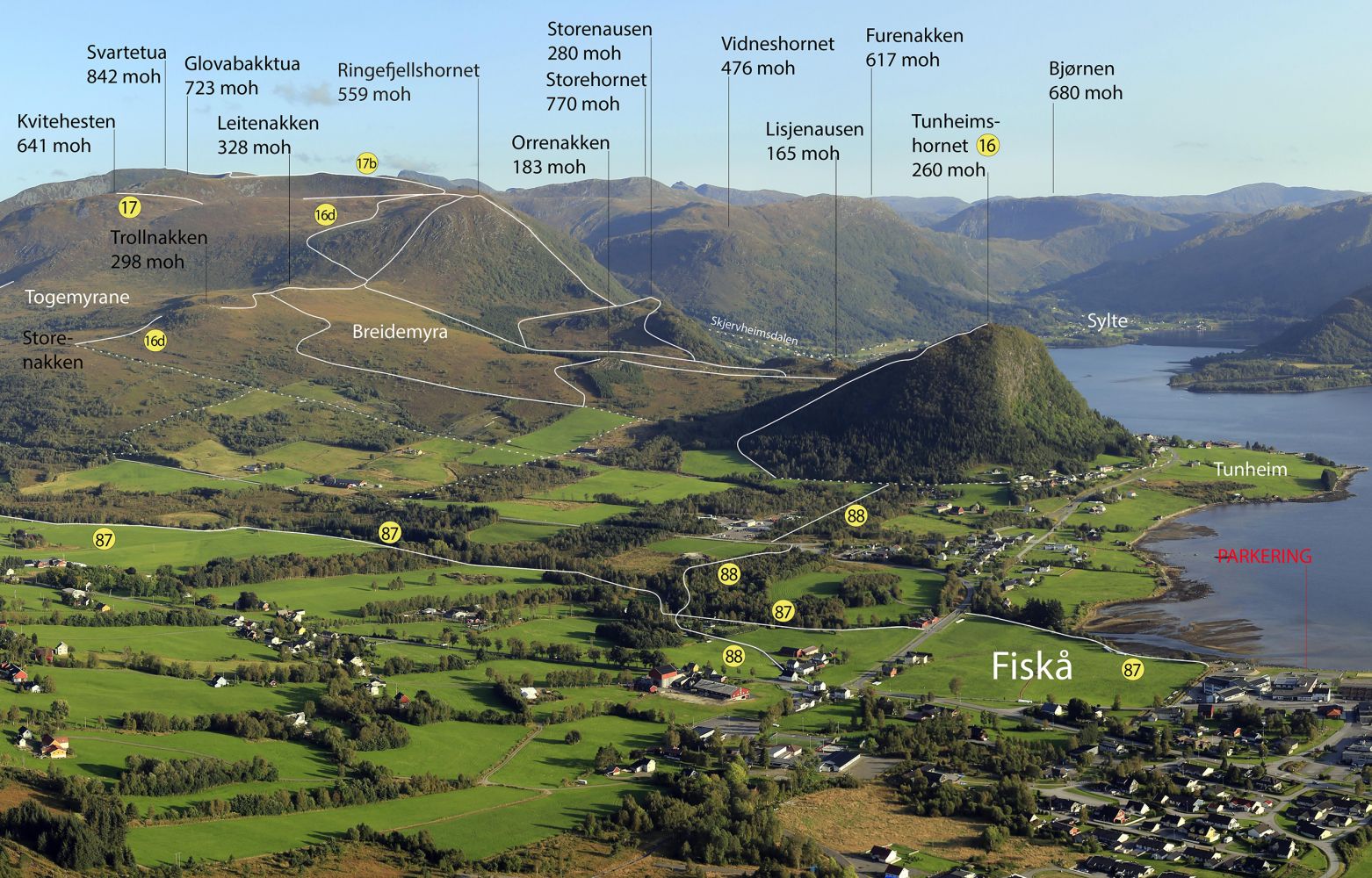
This route is marked with number 88 on the aerial photo.
Access and parking
The most convenient car park is by Combisenteret.
Hiking route
Green
Distance
1,86 km one way
Elevation
24 m
Duration
1 t. 0 min
Sesong
Winter, Spring, Summer, Autumn
Highest Point
34 masl
Signage
No signage or markings
Map route
Driving directions
API endpoints
Route data
GeoJSON

 Driving directions
 Route data