The trail to the Ikornneset spit passes through a well established outdoor area with rich cultural landscape. The trail is equipped with a toilet building at the start, tables and benches, swimming area and nice fishing spots along the way, as well as several information boards guiding you through the area and the things you can experience here.
Route description
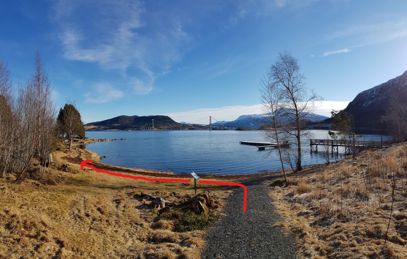
Although it is a short trail, it offers wide variety of types of terrain. The trail starts on the left of the toilet building at the car park. From here, follow the gravel hiking trail for about 200 metres and take the turn to the left along the coastline. After about 50 metres of walking along the coast, turn off to the left and follow the path as is turns away from the seaside. The first section of the path runs through an open mixed forest. The path itself can be hard to follow here at times. After you walk past the burial mound on your right, the path will become more visible as it takes you through the coniferous forest area. Here you will be walking on some tree roots that can get slippery when it is wet outside. After another patch of mixed forest with a clear path, you will come across a wooden bench. Turn left and you will soon see the trail destination up at the top.
The trail destination with the Stikk UT postbox is located at the top of the furthest part of the Ikornneset spit with a great view of Meeknoken and Freikollen mountains.
Access and parking
The trail starts from the Einnesvegen road by the old milk plant in Høgset. The easiest way to get here is by car, but you can also take a bus running between Molde and Kristiansund and get off at the bus stop along the E39 road near the Gjemnessund Bridge.
If you are coming from the Gjemnessund Bridge and E39, follow County Road FV279 (look for the signs to Gjemnes and Eide) for about two kilometres. The turnoff onto Einnesvegen is marked by the sign for Ikornneset. Drive straight ahead past the entrance road to the plant and park your car near the toilet building. The distance from Eide to Einnesvegen via County Road FV279 is about 20 km.
Car park near the toilet building along Einnesvegen.
Hiking route
Green
Distance
0,34 km one way
Elevation
3 m
Duration
15 min.
Sesong
Winter, Spring, Summer, Autumn
Highest Point
13 masl
Signage
Signed
Mobile coverage
Map route
Public transport
There is an express bus connection between Volda and Kristiansund with a stop by the Gjemnessund Bridge. The walking distance from here to the starting point of the trail (Einnesvegen) is 1.7 km via County Road FV279. To plan your trip, please go to http://www.frammr.no/
Other
There might be goats gazing along the trail in summer. Please show your consideration.
Heavy snowfalls are quite rare in the area, so the trail is available for the most part of the year. There can still be ice on the roads, so using crampons would be a good idea.
Map
Norge map series Sheet 035 Hustadvika and 128 Kristiansund-Sunndalsøra.

 Driving directions
 Route data