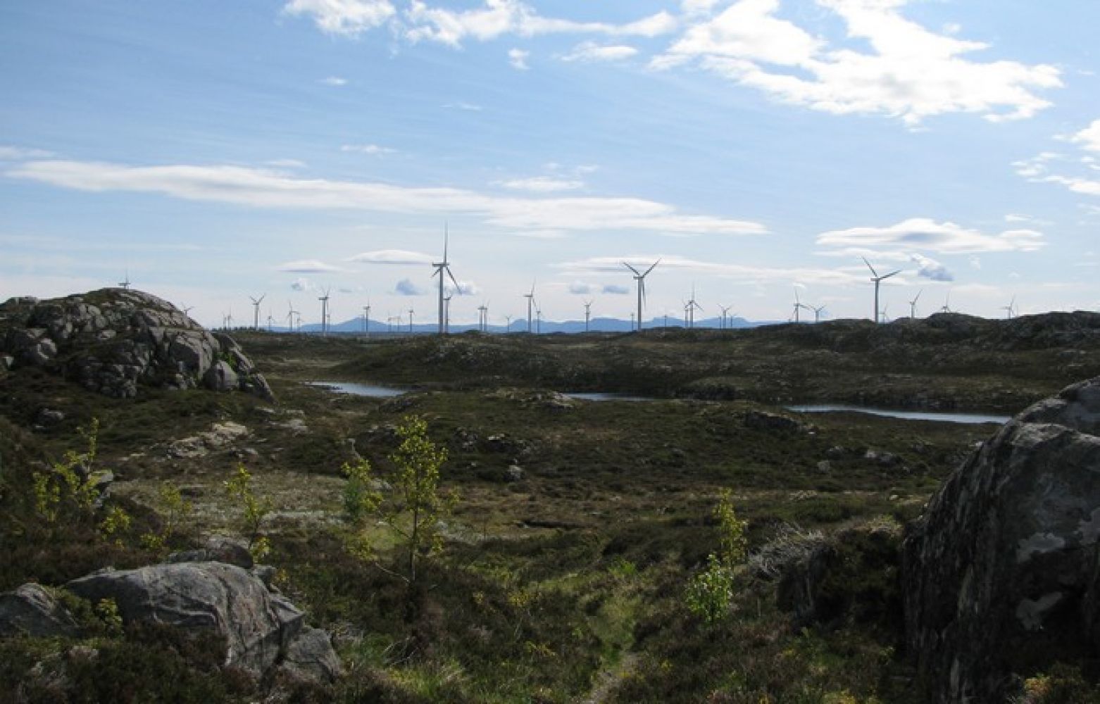
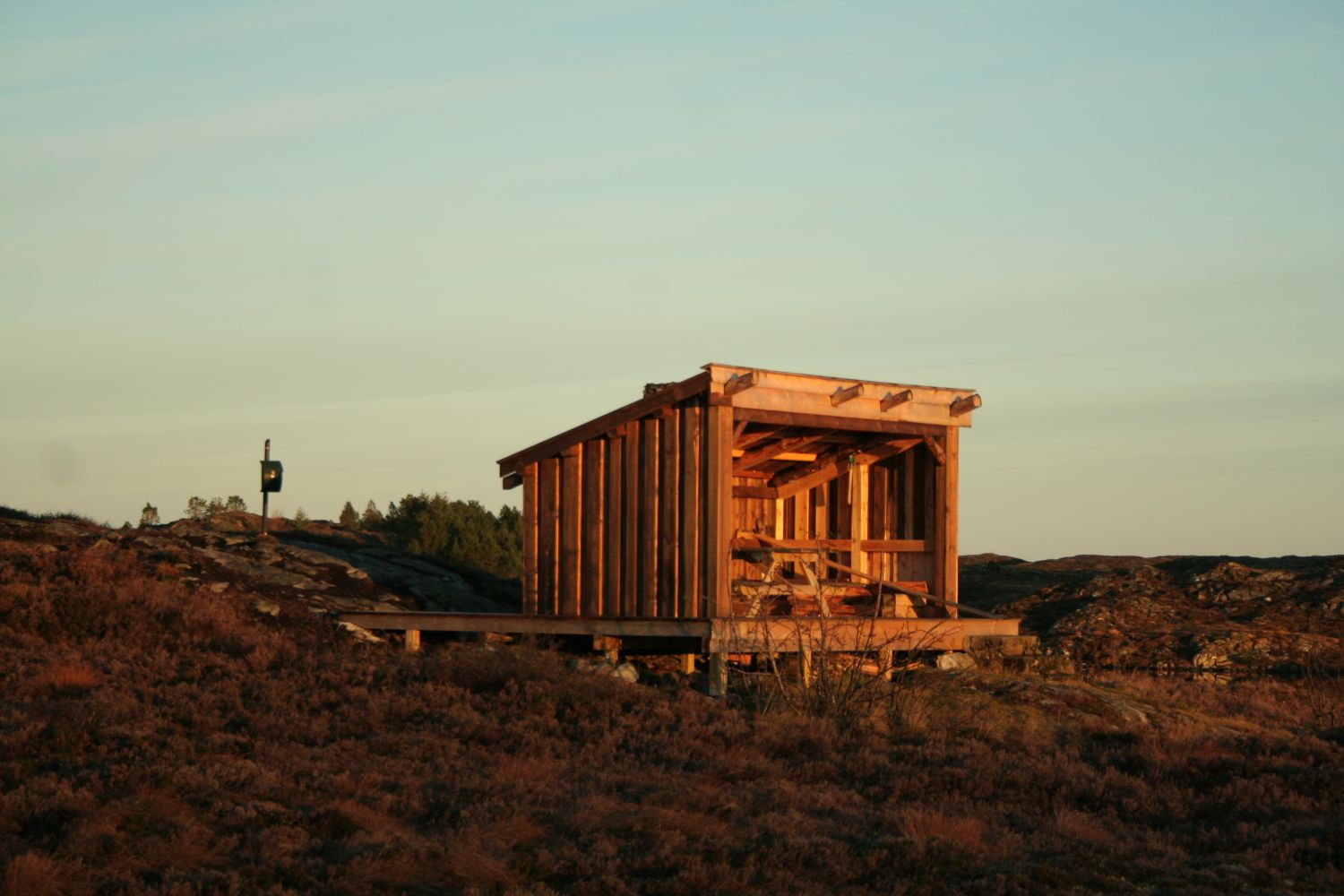
Once you are in the area, you will come quite close to the windmills. You will hear the sound they make, and you can see their dimensions up close. A road goes down from the gravel road/windmill road to the lake. You will find a “gapahuk” shelter down by the lake. Lake Dyrnesvatnet is accessible for people with disabilities and wheelchair users. You will find a sign with the Stikk Ut logo and the telephone number 97986532 near the boom gate. Call this number to get a permission to drive through the boom gate and to the road that goes down to the “gapahuk” shelter. Note that this is available for people with disabilities. The roads in the wind park are also suitable for cycling.
Route description
You can get to the island of Smøla/Edøya by express boat or ferry. From the ferry terminal, follow County Road 669 for about 8 km until you reach a junction. Take the turn to the left in the direction of Dyrnes. It is 25 km from there to Råket. Once you reach the residential area in Råket, you will see a graveyard on your left. A sign pointing to Lake Dyrnesvatnet will be on your right-hand side. Park your car next to the old stadium facility and start walking along the “old road” where the sign points. After walking for one kilometre, turn off from the “old road”. You will see a small sign leading up to a path. Start following the path through the terrain. There might be some wet patches along the way, but it is okay to walk.Aim for the windmills until you find the gravel road/windmill road. Cross this road and you will find a path/road that leads down to Lake Dyrnesvatnet. A “gapahuk” shelter is located down by the lake. Statkraft, Vestsmøla Vel, Smøla Sports Association and Smøla municipality have all contributed to the construction of the road and the “gapahuk” shelter. It is a perfect place for relaxation. On your way back you can choose to follow the path that takes you along the lake down to the golf course in Dyrnes. Please do not walk on the grass. There is a path on the edge of the golf course. Once you reach the residential area, take the turn to the left onto the “old road” and continue walking to Råket where your car is parked. If you would like to extend your hike, you can also visit Dyrnestua a little further northeast on your way down from Lake Dyrnesvatnet. You can also take a walk in Øyrin. There is a landscaped area that goes from the golf course around the lake and down in the direction of the village.The expected time for this hike is 1–2 hours depending on how fast you walk.
You will find the trail postbox near the “gapahuk” shelter by Lake Dyrnesvatnet. This is the trail destination where you can sit and relax after walking.
Arrival and parking
There are several roads/paths leading up to the trail destination, but the one described here starts from where our sign is installed. You will find our sign near the Råket Stadium on the right side of the sports ground. An old municipal road to Dyrnes goes here.
You can park your car by the turnoff to the football pitch.

 Driving directions
 Route data