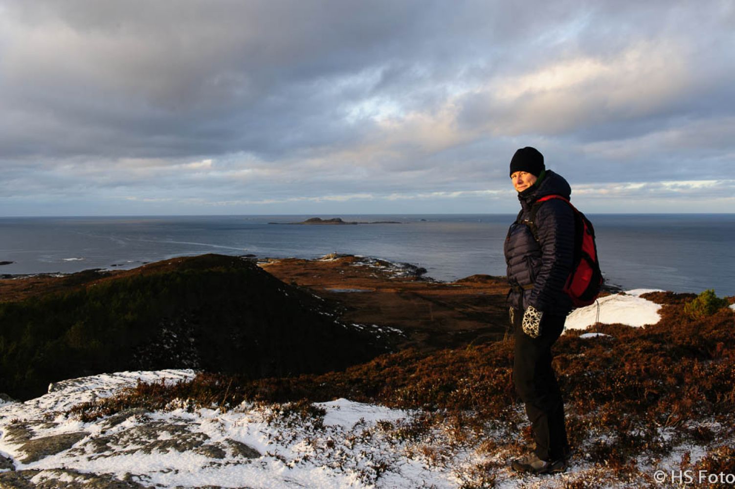
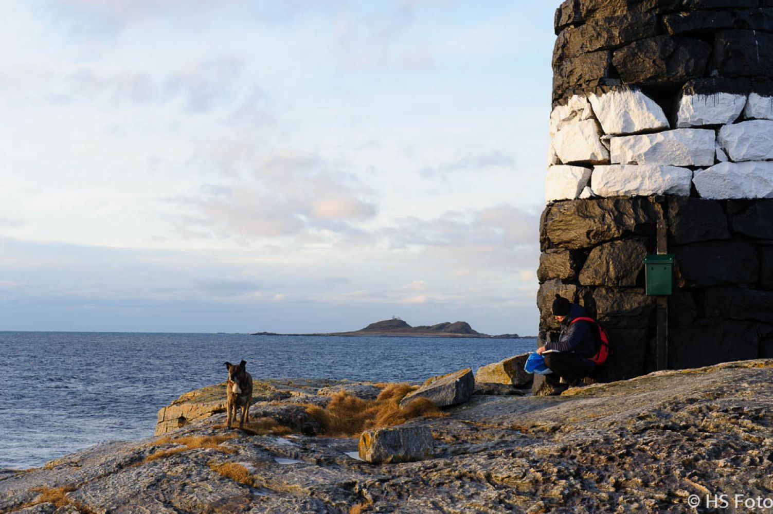
This trail will take you out to the wild seaside in the west of the southern part of Vigra, with a unique view from the top of Mount Synnesfjellet and a beautiful hike towards the furthest point of the island facing the open sea. This spectacular trail is a great choice for both the nice and stormy weather! Here you will also find the navigation mark, a popular local tourist destination. The navigation mark is a large round stone cairn painted into the signal colours black and white. It rises high above the sea overlooking the furthest rocky coast of the island in the west. This is a fantastic viewpoint for observing both the Midnight Sun and the Northern Lights. The beautiful light inspires photographers to take great shots. You will also find a trail postbox with a journal where you can write in your name. (Please keep in mind that there is a whole network of trails in the area with various starting points, route alternatives and lengths, leading up to both the navigation mark and the area to the north from here, towards Blimsanden. Some of these will be uploaded as separate “morotur” trails.)
From the top of Mount Synesfjellet follow the road past the antenna structure. A clear path runs down the mountain ridge to the west. This path will take you down to the seaside. Once you have come out of the forest you will have to cross some marshland. The worst sections of the marshland are laid out with planks of wood. The path to the Brimneset spit itself is clear. A couple of hundred metres before your destination point, you will see a sign pointing back to the place you came from: Røsvika and Synesfjellet. Walking out to the large beautiful cairn on the Brimneset spit is a must. Here you will find the trail postbox with a trail journal for the visitors where you can write your name in.You can follow the same way back or take the right turn at the sign and continue walking south. After about 80 metres you will walk through a stone fence. From here, follow the path that goes east along the stone fence and electrical transmission towers towards Kjerringa mountain. There is a clear and well defined walking path that will take you back to the residential area.Right after you pass some remains of an old stone-made foundation wall the path splits into two. Both forks will take you up to Mount Synesfjellet, but the one that goes south passes through the residential area, and you will then follow the motor road around and up the mountain. This way is a bit longer, but completely fine. The path will take you eastwards through the power line. Follow the power line up the trail made by the animals running north. The electrical transmission tower will be in front of you all the time showing you the right way. The path here is quite clear and should be easy to follow for everyone.From the car park in front of the Viking community house, walk to the left and you will soon come to the junction with the signpost to Røsvik. Walk past this junction and continue further for another 150 m, then take the next turn up to the right. This is the Fjellvegen path which will take you up to the top of Mount Synnesfjellet. On your way up you will get a great view of Røsvikvågen and the sea in the west. Before you reach the top, you will be passing by the radar installation detecting the approach to the airport. From the top of the mountain you will see the coastal landscape which you will be walking through on your way further. Enjoy the wonderful 360-degree panoramic view with islets and lighthouses on the horizon. Synnesvågen lies down to the east, while Røsvikvågen is to the west from here. You will see the Erkna Lighthouse far in the southwest, the Storholmen Lighthouse — a bit further north and the Røssholmen Lighthouse will be the farthest towards the north. You will also spot the navigation mark at the edge of the seaside making a straight line with the Erkna Lighthouse, the navigation mark will be visible all the way down. (If you are pushing a baby carriage, it will be fine until this point, but not further down.) From here, follow the path that runs down the mountain swinging around the rocks and slopes along the way. Keep to the left side of the edge of the forest. When you reach the fence, keep to the right side and follow the path westwards across a marshy area. The wettest sections are laid out with planks of wood.Once you approach the seaside in the west, the path swings back to the fence. There is a gate here, walk through it. The path further will be a bit less obvious, as it crosses some patches of rocky terrain as well as some smooth rock slopes. But the trail destination is visible all the way down. It is strongly recommended to keep your feet firmly to the ground, because the rough sea can make the rock slopes very slippery. But in good weather when the sea is calm there is nothing more spectacular than wander around the smooth rock slopes towards the navigation mark. You can find some nice driftwood in the bay here if you would like to make a fire. But if you are looking for a nice rest area when the weather is good and the wind is blowing northeast, it will be a good idea to walk to the trail destination. Walk ahead of the navigation mark. Below the edge of the plateau there is a nice and beautiful rest area surrounded by unusual rock formations, right next to the ocean. On your way back walk over the smooth rocks until you reach the trail sign for Røsvika. Walk down and to the right through the stone fence and follow the path further east along the fence. The path is clear and it will take you straight to the residential area. You can also choose to go straight down towards Synnesvågen and walk back following the coastline. The trail here is unclear and the surface is more uneven.Once you are in the residential area, just walk straight ahead along the Bureisingsvegen road until you come across County Road 136. Take the left turn here and walk up the hill. At the top of the hill you will see the Solbakken school on your right-hand side. Continue walking further until you reach the starting point again.
The same as the starting point
It is also worth mentioning that there are many looped trails starting from the same point / car park. You can for example follow the path back from the navigation mark via Røsvikvågen and Røsvika and then all the way up north to Blimsanden, if you want to extend your trail further. After some walking along the country road you will come back to the starting point.
This trail runs through the island of Vigra and starts from the Viking community house. Here is how you can get there: Starting from the Esso petrol station in Gjøsund, once you cross the strait to Vigra drive north along National Road 658 for 4 km. Right after you pass under the runway of the airport, take the turn to the left at the sign to Synes and follow County Road 135 westwards parallel to the runway. After 2.7 km take the turn to the right at the sign to Blindheim. AT the next junction after 800 m down this road, turn left and drive straight ahead for another 800 m until you see quite a large building on the left side of the road. This is the Viking community house with a large car park. Here you can park your car and begin your hike.
(It is also possible to drive further into the residential area in Synnesvågen and start the trail from there, if you want a shorter option. In that case drive further until you see a sign to Synnesvågen pointing right. Follow the sign here and drive along the Bureisingsvegen road until it ends. On the edge of the forest area you will see a sign for the hiking trail and a cobblestone path which leads you into the forest. This option does not include walking across the mountain)
Viking community house (please see the description under “Where does the trail start?”)
Duration
1 t. 50 min.

| Surface type |
Distance |
| Sti |
0,5 |
The most convenient way to get here is by car, bicycle or on foot. But there is also a bus connection from Ålesund to this area via bus route 662 “Fastlandsbussen” with departures 5 times a day on weekdays.
It could be somewhat damp along this trail. There are planked footways on certain sections of the trail.
Goretex/waterproof shoes are recommended for hiking in the area.
For geocachers: there is a post on Brimneset!
Vigra, Sheet 1120 II in map series M711 and Ålesund in tourist map series
 Driving directions
 Route data
GeoJSON